Advanced Aerial Imaging & Geospatial Data Solutions
Executing successful aerial data acquisition or film production in the Columbia region involves more than simply deploying a helicopter; it requires sophisticated mission planning, seamless sensor integration, and navigating regulatory approvals. Helicopters Over Columbia serves as your dedicated mission coordinator. We meticulously evaluate your specific data or footage requirements, identify the ideal helicopter and pilot for that precise operational profile, and manage all necessary flight planning and permitting. This streamlined approach ensures a single point of accountability and a turnkey solution for your complex aerial projects.
Cinema & Broadcast Videography
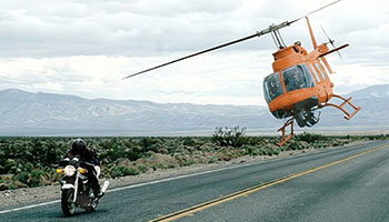
From capturing dynamic scenes for feature films to providing live broadcast support for major events in the Columbia area, we deliver the stable, high-performance aerial platforms required by Directors of Photography. Our operations seamlessly support industry-standard stabilization systems, such as Shotover, Cineflex, and Tyler Mounts. We coordinate meticulously with your production crew to ensure flawless shot execution and deliver on your creative vision.
Aerial Photography
Achieve compelling high-resolution imagery for marketing, detailed real estate portfolios, and essential project documentation. We ensure expert handling of lighting, angles, and composition, delivering professional, magazine-quality stills tailored precisely to your visual objectives.
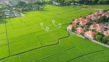
LiDAR & Geospatial Surveying
Beyond merely capturing images, we deliver actionable geospatial data. Our services support high-precision LiDAR acquisitions, orthomosaic mapping, and 3D terrain modeling crucial for effective urban planning across the Midlands, detailed utility infrastructure inspection, and comprehensive environmental monitoring needs.
Utility & Asset Inspection
For critical infrastructure, we facilitate rapid, detailed inspections of transmission lines, pipelines, and cell towers throughout South Carolina. Helicopter operations provide the stable hover capability and precise flight control essential for high-fidelity asset auditing and preventative maintenance planning.
Technical FAQ
We ensure compatibility with industry-standard cinema and survey equipment. Our platforms are readily configured for all major camera mounts, including Shotover (F1, K1), Cineflex, and Wescam systems, also supporting lighter cinema payloads like Tyler Minigyro and Middle mounts.
Successfully navigating urban environments, such as those found in Columbia, requires careful planning and regulatory compliance. We manage all necessary airspace authorizations and flight plans for city operations, ensuring every aerial project is executed legally and safely within complex controlled airspace parameters.
We offer flexible service options, whether providing a dedicated sensor operator as part of a turnkey solution or accommodating your specialized creative team. Should your crew join the operation, we conduct thorough briefings on safety protocols and air-to-ground coordination procedures for seamless execution.
The data delivered can be tailored to your specific requirements based on the sensor payload used. We provide raw point clouds (LAS/LAZ), detailed orthomosaic maps (TIFF/ECW), or processed 3D meshes, actively collaborating with your GIS team to ensure full file compatibility and integration.
Gallery
Aerial Photography
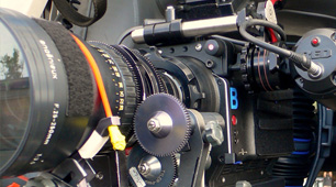
Camera Equipment
Camera Mounts
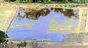
Damage Survey
Real Estate Survey

Aerial Videography
Comprehensive Aerial Photography & Videography Services
To discuss your specific aerial photography requirements in Columbia and receive a complimentary, no-obligation consultation, please contact Helicopters Over Columbia at 1-855-445-8965. We are ready to assist you.